Point Clouds for Pre Production, Location Scouting, Tech Surveys, Production Design, Art Department Set Design, Construction, Set Decorating, Camera tracking, VFX, Post Production Editing
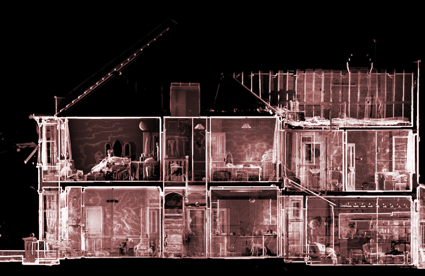
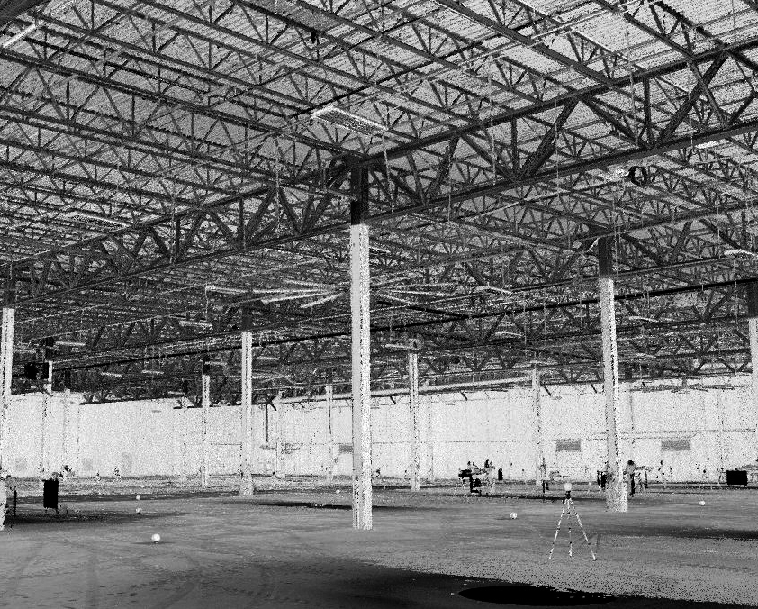
As Built Locations
We capture interior/exterior precision detailed 3 dimensional pointcloud map of any location
PreProduction stage mapping
Design and build your sets into any space with detailed accuracy to .6mm
Production Designs from concept to final cut
Documentation of all standing sets into permanent digital assets
Aerial Drone Mapping
Create detailed digital overhead maps of any environment
Why SetScan?
High definition LiDAR Point Cloud mapping is technologically esoteric requiring vastly expensive hardware and software to operate
We are specialized and dedicated to meeting the specific needs of the Film and Television industries, providing services normally out of reach to many Art/VFX, and other department budgets
Qualified, Experienced Tecnicians
Excellent Value Pricing
Prompt Delivery
What You Get
The highest quality and definition Point Cloud data maps, refined, aligned, and delivered promptly to your production pipeline
We also offer Mesh file conversions from the point cloud which can be retopologized from high resolution poly mesh to lower poly count mesh for modelling and animation